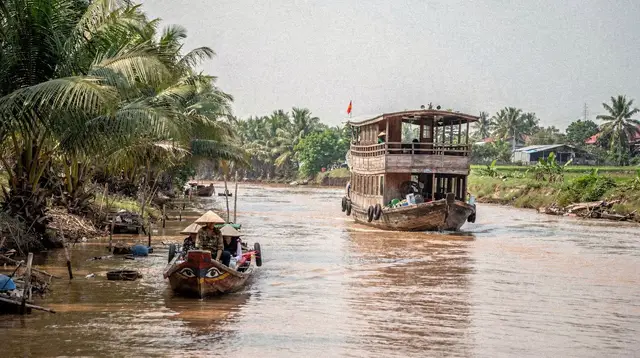
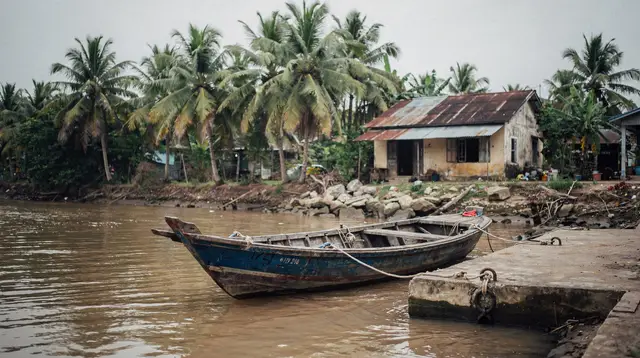
A Port City Facing the Sea, Not the River
Most travellers arrive at Mekong Delta planning with a mental map built around the river itself: My Tho and Ben Tre close to Ho Chi Minh City, Can Tho further in as the delta’s main hub, Chau Doc up near the Cambodian border. That map is accurate for the branches of the Mekong River, but it leaves out an entire coastline. Rach Gia sits on the opposite side of the delta from all of it, facing west onto the Gulf of Thailand rather than inward onto a river channel, and the difference shows in everything from the skyline to the reason people pass through.
Where the river towns are built around canals, orchards and floating trade, Rach Gia is a working port: fishing fleets, a harbour, a seafront boulevard, and a terminal that exists mainly to put people on boats bound for Phu Quoc island. It is administratively part of the same broad delta region as Can Tho, and it shares some of the same Khmer heritage found further along the border, but its daily rhythm is coastal. Think of it less as another stop on the river circuit and more as the hinge between the inland delta and the sea.
This distinction matters for planning. A trip built around Can Tho and the Cai Rang Floating Market is a river trip — boats on canals, orchard visits, a market that trades on the water at first light. A trip that includes Rach Gia is doing something different: using the delta’s western edge as a launch point toward the coast and the islands, or exploring a Gulf-facing city that most delta itineraries skip entirely.
Why Rach Gia Gets Mixed Up With Can Tho
The confusion is understandable. Both cities are provincial capitals in the far south, both sit within the broader area this site groups as the Mekong Delta, and both appear on lists of “delta cities to visit.” Guidebooks that treat the delta as a single homogenous region tend to flatten the distinction between the river network and the coast, and Rach Gia gets filed under “delta” without the geographic nuance that actually explains what a visit there feels like.
The clearest way to hold the two apart: Can Tho’s defining feature is the river and its floating trade, reached by boat before dawn. Rach Gia’s defining feature is the harbour and the ferry terminal, reached by road, and its own waterfront looks out at open sea rather than at a maze of tributaries. If an itinerary description mentions floating markets, orchards or canal boats, it is describing the river towns. If it mentions a ferry to an island, a seafront promenade or a fishing harbour, it is describing Rach Gia.
The two do connect to each other by road, and travellers doing a longer loop through the south-west sometimes link them in one trip — see the tour options further down this page for a version of that route — but they are not the same kind of place, and a guide written for one will mislead a visitor to the other.
The City Itself
Rach Gia’s centre sits on a small peninsula pushed out into the gulf, with the sea on multiple sides — an unusual layout among Vietnamese provincial capitals and part of what gives the waterfront its openness. The old quarter carries a visible Khmer and Chinese layering, a reminder that this stretch of coast has long been a meeting point of communities rather than a purely Vietnamese river town. Temples and pagodas around the centre reflect that mix more directly than anything found in the river towns further east.
The market culture here leans toward the sea rather than the orchard: this is a place to eat seafood pulled straight off the boats moored in the harbour, rather than the fruit-and-rice specialities that define the river delta’s food identity. Evenings along the waterfront have a genuinely coastal feel — sea breeze, fishing boats returning, a promenade atmosphere that has more in common with Vung Tau than with any of the river towns.
Because most travellers pass through rather than linger, Rach Gia has not been built up as a sightseeing destination in the way Can Tho or Chau Doc have. That is arguably part of its appeal for the curious: a working provincial city that has not been shaped around tourism, sitting exactly where the delta meets the gulf.
The Harbour and the Route to Phu Quoc
The single fact most travellers need about Rach Gia is functional rather than scenic: it is one of the mainland’s departure points for ferries to Phu Quoc island. For anyone routing overland through the far south-west rather than flying directly to the island, Rach Gia’s terminal is the practical link between the Mekong Delta side trip and the beach leg of a longer Vietnam itinerary.
This guide does not cover ferry schedules, fares or crossing conditions — those details change with the season and the operator, and belong with the people who track them. For everything related to getting to and from Rach Gia by road, boat or the wider delta transport network, see Getting to the Mekong Delta and Coast by Bus, Van and Boat. What matters here is the geography: Rach Gia is a coastal gateway, not a river stop, and travellers heading to Phu Quoc by land-and-sea should think of it as the last mainland city before the crossing rather than as an extension of the Can Tho river circuit.
Around Rach Gia
The province around the city carries some of the same natural and cultural texture found elsewhere on the delta’s western fringe. Inland toward the border with Kien Giang’s forested reserves, the wetlands and cajuput forest habitat echo the landscapes covered in this site’s guide to Tra Su Cajeput Forest, further north near Chau Doc — a useful comparison for travellers weighing which cajuput-forest excursion fits their route.
Khmer communities in the surrounding countryside maintain pagodas and traditions that connect to the broader pattern described in Khmer Temples of the Mekong Delta, a heritage thread that runs from Soc Trang through this western coast rather than being confined to the river towns. Birdlife in the wetlands south of the city also draws the occasional specialist traveller, in the same spirit as the excursions detailed in Mekong Delta Bird Watching.
Homestay-style visits, where they exist in this part of the province, follow the general pattern described in Mekong Delta Homestay, though the coastal setting gives them a different flavour from a homestay on a river island near My Tho or Vinh Long.
Rach Gia in a Longer Itinerary
Because it sits off the main river circuit, Rach Gia rarely anchors a short trip on its own. It works best in one of two roles.
The first is as a stopover on the way to or from Phu Quoc, for travellers who prefer an overland-and-ferry approach to the island rather than flying. In that role, an overnight in Rach Gia breaks up a long travel day and gives a glimpse of a part of the delta most visitors never see.
The second is as one leg of a deeper south-west loop that also takes in Chau Doc, Ca Mau and the wetlands between them, for travellers who have already done the classic Can Tho and floating-market circuit and want to go further off the standard route. The tours listed below cover both patterns, linking Rach Gia to Can Tho or back toward Ho Chi Minh City as part of a multi-day route through the delta’s less-visited south-west.
For a wider view of how much time this whole region deserves, see How Many Days in Southern Vietnam, and for a starting point on sequencing a longer trip, Choosing a Mekong Delta Departure Point lays out how a city like Rach Gia fits alongside the more familiar options.
Travellers extending all the way out to the islands may also want Con Dao Archipelago Guide, a different island entirely, on the opposite coast, but a useful point of comparison for anyone deciding between Vietnam’s two main southern island escapes. A full south-west loop of this kind is also sketched out in Seven Days: South Vietnam Grand Loop.
Multi-Day Tours Through Rach Gia and the South-West
The tours below are the practical way most travellers actually experience this part of the delta, since Rach Gia is more often a routed stop than a solo destination. Each combines the city with either the cajuput-forest wetlands, the river towns to the east, or a longer run back to Ho Chi Minh City.
a multi-day route out of Rach Gia into the cajuput-forest wetlands by bicycle suits travellers who want the coastal city paired with the province’s quieter nature side rather than another river-market stop.
For a route that threads Rach Gia together with the delta’s best-known river hub, a multi-day journey connecting Rach Gia through to Can Tho is built exactly for travellers doing the coast-to-river version of this region, rather than treating the two as interchangeable.
Travellers working Rach Gia into a longer return leg can look at a several-day Mekong Delta route running from Rach Gia back to Ho Chi Minh City, which strings the coastal city together with river-town stops on the way back to the capital of the south.
For travellers who prefer to base themselves in Ho Chi Minh City and take the delta as a series of day and multi-day trips rather than an overland loop, a Ho Chi Minh City departure covering the Cu Chi Tunnels alongside the Mekong Delta and a hands-on option combining kayaking, cycling and a cooking session in the delta both give a taste of the river side of the region before or after a separate push out to the coast.
See Things to Do in Rach Gia for the fuller range of activities and excursions based in and around the city.
Rach Gia FAQ: Location, Phu Quoc Ferries and the Gulf Coast
Is Rach Gia in the Mekong Delta?
Administratively and in the broad regional grouping this site uses, yes — Rach Gia belongs to the same south-western area as Can Tho, My Tho and Chau Doc. Geographically and in character, though, it is a Gulf of Thailand coastal city rather than a river town, and it does not share the canal-and-orchard landscape most people picture when they think “Mekong Delta.”
Is Rach Gia the same kind of place as Can Tho?
No. Can Tho is built around the Mekong River’s branches and its floating trade, reached by boat. Rach Gia is a fishing port and provincial capital facing the open sea, reached by road, whose main function for most travellers is as a gateway to Phu Quoc rather than a river-based sightseeing stop.
Why do people confuse Rach Gia with the rest of the delta?
Because guides and itineraries often describe “the Mekong Delta” as one region without separating its river-facing interior from its west-facing coast. Rach Gia sits within the administrative area but on the coastal side, which gets lost when the whole delta is treated as a single, uniform destination.
Is Rach Gia a good base for exploring the Mekong Delta’s floating markets?
Not really. The delta’s best-known floating market, Cai Rang, trades near Can Tho, on the river side of the region, and is a considerable distance from Rach Gia’s coastal position. Travellers focused on floating markets and river life are better based around Can Tho itself.
How do travellers usually get to Phu Quoc from Rach Gia?
By ferry from the city’s port terminal. This guide does not cover crossing schedules or fares, since they shift by season and operator — see Getting to the Mekong Delta and Coast by Bus, Van and Boat for the current transport picture.
What is there to do in Rach Gia itself, beyond the ferry connection?
A working seafront with a genuinely coastal atmosphere, a historic centre with Khmer and Chinese influences, seafood built around the local fishing catch, and access to cajuput-forest wetlands and Khmer pagodas in the surrounding countryside. It rewards travellers with an interest in the delta’s less-visited coastal fringe rather than those looking for a checklist of major sights.
Can Rach Gia be combined with Chau Doc or Ca Mau in one trip?
Yes — all three sit on the delta’s western and southern edges, away from the central river towns, and several multi-day routes link them together rather than pairing Rach Gia with the more central Can Tho circuit alone. See the tour options above and How Many Days in Southern Vietnam for help sizing that kind of route.
Does Rach Gia have the same festivals and river culture as Can Tho?
Not the same river-market culture, since Rach Gia’s identity is maritime rather than riverine, but it shares the region’s broader Khmer heritage, visible in its pagodas and in the communities of the surrounding province, in a way that connects it more to Soc Trang and the border area than to the orchard towns along the Mekong’s branches.