Finding your bearings in Vietnam’s biggest city
Ho Chi Minh City sits on the Saigon River, in the south of a country that stretches over 1,600 km from north to south, and it is easy to arrive with the wrong mental map. This is not the capital of Vietnam — that is Hanoi, about 1,100 km to the north, a distance that rules out any thought of a day trip between the two. What Ho Chi Minh City actually is, is Vietnam’s largest city and its economic engine, the place where the country’s exports, imports and much of its energy pass through.
It is also, in ordinary conversation, still called Saigon almost as often as its official name — a habit that dates to the years before 1976 and that has never faded, especially for the central districts where most visitors spend their time. Expect to hear both names used interchangeably by taxi drivers, hotel staff and other travelers, sometimes in the same sentence.
The city fans out from the river in a way that rewards a little orientation before you start walking. The commercial and administrative core is District 1, and radiating from and around it are a handful of districts each with a distinct character, plus a fast-growing area across the water. None of this needs to be memorized before you land, but it helps explain why a map of the city looks the way it does, and why some neighborhoods feel colonial and quiet while others feel dense, commercial or entirely new.
Districts, river and contrasts: how the city is put together
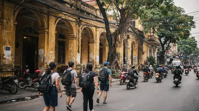
At the centre, District 1 carries the bulk of what first-time visitors come to see: markets, government-era landmarks, museums, a walking street and a cluster of rooftop bars and hotels. It is where French-colonial buildings — a cathedral under long-term restoration, a grand post office, tree-lined boulevards — sit within a few blocks of glass towers and neon signage, and that contrast, colonial next to modern, is probably the single most photographed thing about the city. For a deeper sense of how this district is laid out street by street, the District 1 neighborhood guide is a useful companion once you’re ready to go beyond an overview.
Just west and southwest of the centre, Cholon is the city’s historic Chinatown, spread across Districts 5 and 6, older and denser than District 1, with its own markets, temples and rhythm. It rewards visitors who want the version of the city that existed before the 20th-century boulevards were laid down, and the Cholon neighborhood guide is the natural next stop for planning a visit there. Smaller, quieter District 3, with its villas-turned-cafés, and District 4, known for its dense street-food lanes, round out the inner core, each a short ride from District 1 rather than a destination requiring a full separate day.
The river itself, the Saigon River, is not incidental scenery — it is the reason the city exists where it does, a working waterway that still carries barge traffic past riverside bars and new towers alike.
Across it, in what used to be Districts 2 and 9 and is now folded into Thu Duc City, a cluster of newer neighborhoods (Thao Dien among them) has grown up around expat life, cafés and, increasingly, the skyline itself — Landmark 81, the country’s tallest tower, rises from the Binh Thanh side of that same stretch of river. Seeing the water, whether by walking the riverfront promenade or taking a short boat out onto it, is one of the more reliable ways to feel the scale of the city rather than just its street-level bustle.
History sits close to the surface almost everywhere in the centre. The War Remnants Museum is the most visited of the city’s history sites and, along with the former Independence Palace nearby, forms the backbone of most people’s first encounter with the more recent past of the city and the country. None of these sites need much advance planning to simply know they exist and roughly where they sit — Ben Thanh Market, the cathedral, the post office and the palace are all within a compact, walkable cluster in District 1 — but each deserves its own visit rather than being folded into a rushed pass-through, which is why deeper coverage of each lives on its own page rather than here.
Markets are another thread that runs through the whole city rather than sitting in one place. Ben Thanh Market, with its landmark clock tower, is the best known and the most central, but Cholon has its own market culture built around Binh Tay Market and the temples around it, and each district has its own smaller wet markets that see almost no tourist traffic at all. Together they say something true about the city: it is not really one destination but a set of overlapping ones, colonial-era landmarks, a Chinese-founded old town, a river working its way through both, and a skyline that keeps adding new pieces.
How long to stay, and how the seasons shape a visit
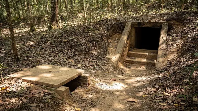
Two to four days is a comfortable window for the city itself — enough to walk District 1 without rushing, spend a half-day or so in Cholon, take in the river, and still leave room for at least one longer outing beyond the city limits, whether that’s the tunnels northwest of town or the delta to the southwest. Travelers building a longer southern Vietnam itinerary tend to treat the city as a base rather than a single stop: arrive, settle in for a couple of days, then head out to nearby regions and return, or move on toward the coast.
The guide to how many days to spend in southern Vietnam walks through how that balance tends to play out depending on how much of the wider region you want to see, and the one-day Ho Chi Minh City highlights itinerary is a useful reference even for a longer stay, since it maps out a sensible order for covering the centre.
Seasonally, this is a two-season city, not a four-season one — a distinction that matters because guidance written for the north of the country simply doesn’t transfer here. The dry season, running roughly from December through April, is the more comfortable stretch to walk around outdoors, while the wet season, roughly May through November, tends to bring a short, heavy downpour in the late afternoon rather than steady rain across the whole day, which means a wet-season visit is usually still very workable if you build in some flexibility around midday and early evening.
The best time to visit Ho Chi Minh City guide goes further into how the two seasons compare month by month, and travelers curious about the rhythm of the wet months specifically can look at the piece on visiting southern Vietnam in rainy season.
Getting in: Tan Son Nhat and the first hour in the city
Almost every visitor arrives through Tan Son Nhat International Airport, which sits unusually close to the centre — close enough that the ride into District 1 is one of the shorter airport transfers you’ll find in a major Southeast Asian city, traffic depending. There is no rail connection to the airport, so the practical choices are a metered taxi, a ride-hailing app, a shared minibus or the public bus network, and each has trade-offs in cost, comfort and how well it handles luggage.
The airport transfer guide covers those options in more detail, including how to avoid the overcharging that sometimes targets arriving travelers right outside the terminal. A second airport, Long Thanh, is under construction well outside the city in Dong Nai province, but it isn’t in service yet and isn’t something to plan around for the time being.
Once you’re settled, getting around the city day to day mostly comes down to ride-hailing apps for cars and motorbike taxis, supplemented by a growing but still limited metro line and an extensive bus network. Where you choose to stay shapes how much of that you’ll need: the neighborhood-by-neighborhood guide to where to stay in Saigon is worth reading before booking, since District 1, District 3, Thao Dien and the backpacker strip around Bui Vien each offer a genuinely different few days.
Using the city as a base for what’s beyond it
Part of what makes Ho Chi Minh City work so well as a first stop in Vietnam is how much sits within reach of it without requiring a change of hotel. The Cu Chi Tunnels and the wider Mekong Delta are the two most common outings, and both are comfortably done as trips out from the city and back, or combined into a slightly longer loop. Travelers planning that stretch of a trip often start with the three-day Saigon–Cu Chi–Mekong classic itinerary, which sequences the city and its two best-known surrounding regions into a workable rhythm without doubling back unnecessarily.
a guided tour of the city’s centre is a reasonable way to get your bearings quickly on a first day, especially for travelers who’d rather have context on the palace, the market and the war sites from a local guide than piece it together alone. For a version that adds a stretch of water into the mix, a city tour that includes a canal boat ride pairs the street-level landmarks with a look at the city from the river side, which is a genuinely different perspective on how Ho Chi Minh City is laid out.
And for the outing that most visitors end up adding regardless of how they’ve planned the rest of their days, a day tour out to the Cu Chi Tunnels is the most straightforward way to see that site without arranging transport yourself.
A city best understood as several cities
The single most useful thing to carry into a first visit is that Ho Chi Minh City isn’t one uniform place — it’s a river town, a colonial-era centre, an old Chinatown and a fast-rising new skyline, all layered on top of each other and all still called, depending on who’s talking, either Ho Chi Minh City or Saigon. Neither name is a mistake, and neither one tells the whole story on its own.
Give the centre a couple of unhurried days, let Cholon feel distinctly different from District 1, spend some time actually on or beside the river rather than just crossing it, and treat the city as a launch point rather than a checklist, and the contrasts that make it interesting — old next to new, delta next to skyline, a former name that never quite left — tend to make more sense on their own.
Frequently asked questions about visiting Ho Chi Minh City
Is Ho Chi Minh City the capital of Vietnam?
No. Hanoi is the capital, roughly 1,100 km to the north — far too far for a day trip. Ho Chi Minh City is Vietnam’s largest city and its economic centre, not its seat of government.
Why do people still call it Saigon?
Saigon was the city’s name before 1976 and never really disappeared from use. Locals still say it constantly, especially for the central districts, and the train station, a beer brand and countless businesses still carry the name. Both names are correct.
How do I get from the airport into the city?
Tan Son Nhat International Airport sits unusually close to District 1. There is no rail link, so travelers use metered taxis, ride-hailing apps, shared minibuses or public buses to reach the centre.
How many days should I spend in Ho Chi Minh City?
Most travelers find 2 to 4 days enough to cover the centre, Cholon and a riverfront outing at a comfortable pace, before or after using the city as a base for day trips to Cu Chi or the Mekong Delta.
What’s the difference between District 1 and Cholon?
District 1 is the modern and colonial-era centre, with the markets, museums and riverfront towers. Cholon, spread across Districts 5 and 6, is the historic Chinatown, older, denser and organized around its own temples and markets.
Is Ho Chi Minh City walkable?
Central pockets like District 1 reward walking, but the city is large, hot and dominated by motorbike traffic, so most visitors mix walking within a neighborhood with taxis, ride-hailing apps or an organized tour between them.
Does the weather change much across the year?
The south runs on two seasons, not four: a drier stretch roughly from December to April and a wetter one from May to November, when rain usually arrives as a short, heavy downpour rather than an all-day event.