Saigon River Port and Docks: What to See on the Water
What is the Saigon River port in Ho Chi Minh City?
It is the stretch of working docks and quays along the Saigon River through central Ho Chi Minh City, handling river traffic, ferries and cargo barges rather than ocean-going ships. It is a place to watch river life from the bank, not an international seaport, and the ships that call at the city dock much further away, at Phu My.
A working river through the middle of the city
Most visitors meet the Saigon River as a backdrop to a dinner cruise or a sunset boat trip, glimpsed through a restaurant window on the water. But the river through central Ho Chi Minh City is also a working waterway, and its docks and quays are worth a look on their own, from dry land, with no ticket and no schedule to plan around. This page is about that side of it: the barges, the ferries, the loading and unloading, and the stretch of bank where you can stand and watch it happen.
It is worth being clear from the start about what this river frontage is not. It is not an international seaport. No ocean-going ship calls here, and none is meant to. Ho Chi Minh City’s cruise ships and cargo vessels from abroad dock at Phu My, a deep-water port well outside the city, connected to the centre by a road transfer. The docks described on this page sit inside the urban core, along the Saigon River itself, and their traffic is river and coastal barge traffic, not blue-water shipping. Confusing the two is an easy mistake, since both involve boats and both use the word “port,” but they are different places serving different purposes.
What actually moves on the water here
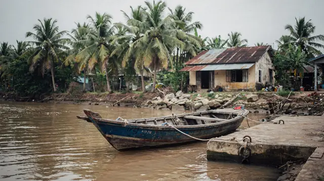
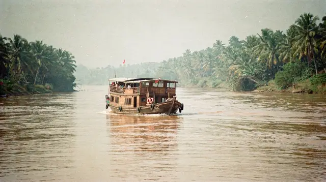
Stand at the riverside for a while in central Ho Chi Minh City and a pattern emerges. Long, low, flat-decked barges pass steadily, riding heavy with sand, gravel, containers or construction steel, headed up or down river between the delta and the city’s building sites. Small passenger ferries cut across the channel, linking the District 1 bank with Thao Dien and the rest of Thu Duc City on the far side, a shortcut that avoids the road bridges. Tour boats and dinner cruise vessels, moored by day along the wharves, head out toward evening. Occasionally a police or river-authority launch passes, moving faster and throwing more wake than the rest.
None of this is dramatic in the way a container port or a naval base might be. It is closer to watching a city’s plumbing at work: unglamorous, constant, and oddly absorbing once you settle into the rhythm of it. The river carries a meaningful share of the raw materials that keep Ho Chi Minh City’s construction boom going, and this stretch of bank is where that traffic is most visible to a pedestrian.
Where to stand and watch
The most straightforward vantage point is the riverside promenade running along the District 1 bank near Bach Dang wharf, a paved walkway that puts you directly above the water with an open view up and down the channel. It sits within easy reach of Dong Khoi and the cluster of hotels and restaurants near the Bitexco Financial Tower, so it folds naturally into a walk through the centre rather than requiring a special trip.
Further along, the open ground around the former Ba Son shipyard site gives a wider, less crowded view of the same channel, with the towers of Thu Duc City rising on the opposite bank as a backdrop. This side of the river has changed considerably in recent years as new development has replaced older industrial land, and the riverfront paths here tend to be quieter than the promenade closer to Dong Khoi.
For an elevated perspective rather than a riverside one, the observation deck at the Bitexco Financial Tower looks straight down onto the water and lets you trace the shape of the channel and the pattern of barge traffic from above, which is a useful complement to watching from the bank.
| Vantage point | What you get | Best paired with |
|---|---|---|
| Bach Dang promenade, District 1 | Eye-level view of barges and ferries, benches, easy access | A walk through Dong Khoi and Nguyen Hue |
| --- | --- | --- |
| Ba Son riverside ground | Wider, quieter view, Thu Duc City skyline across the water | A loop toward Thao Dien |
| --- | --- | --- |
| Bitexco Skydeck | Elevated overview of the river’s course through the city | A stop on a District 1 walking tour |
None of these viewpoints require booking, and none has a fixed way of being “done.” They reward loitering more than checking off.
Best times to watch the traffic
The docks have no opening hours, so there is no wrong time to walk the promenade, but the character of the river traffic does shift through the day. Early morning brings the barges out in force, moving sand and materials toward building sites before the heat and the crowds build up; this is also when the air is clearest and the far bank’s towers stand out sharply against the sky. Midday traffic thins as the heat peaks, though it never stops entirely. Late afternoon into evening is when the dinner and sunset cruise boats moored along the wharves start loading passengers and pulling out into the channel, so this is the stretch of the day when watching from the bank and watching from a departing tour boat overlap most closely, with the pedestrian view and the deck view of the same water separated only by a gangplank.
Sunset itself is the single best window for photography from the promenade, since the light comes in low across the water and catches both the barges and the Thu Duc City skyline at the same angle. It is also, unsurprisingly, the busiest time on the walkway, since it is when the cruise boats depart and when local residents come out for an evening walk along the same stretch of bank.
Not the same thing as a river cruise
It bears repeating, because the two get mixed up constantly: watching the docks from the bank and taking an organised boat trip on the Saigon River are separate activities. This page covers the first. If what you actually want is to be on the water, whether for a relaxed evening with the skyline lit up, a formal dinner service, or a countryside run out toward Thanh Da, that is a bookable experience with its own logistics, and it is covered on its own pages rather than repeated here.
A short Saigon River sunset cruise puts you on deck as the light changes over the skyline, while a Saigon River dinner cruise adds a seated meal to the same stretch of water. Travellers who want something more active than a cruise deck sometimes look at a kayaking trip on the city’s canals instead, which is a different kind of waterway experience again, closer to the smaller channels than to the main river.
Among the bookable options, a compact evening outing like the Saigon River luxury mini cruise covers the same channel you will have been watching from the bank, seen instead from the deck. Travellers who want a longer excursion that leaves the built-up centre behind sometimes choose the Saigon River cruise out to the Thanh Da countryside, which trades the docks and towers for a quieter, greener stretch of river further from the centre.
For a shorter, low-commitment loop that still takes in the main waterfront, the lively Saigon River sightseeing cruise covers the same ground the promenade view takes in, from the water rather than the bank.
Evening options range from a simple drinks-and-skyline outing, such as the Saigon River sunset cruise with drinks, up to a full seated meal on the water, like the romantic Saigon River dinner cruise. Both depart from wharves along the same stretch this page describes, so anyone who has already scouted the docks from the bank will recognise the departure point on the night of the cruise itself.
The river’s place in the wider city
The Saigon River is not incidental to Ho Chi Minh City; it is the reason the city sits where it does. The docks and quays through the centre are a working continuation of a river system that reaches from the Mekong Delta in the southwest through the city and out toward the coast near Can Gio and Vung Tau. Barges seen passing through the centre on any given afternoon may be headed toward or from any of those directions, part of a much longer inland and coastal network rather than a purely local loop.
That river geography also explains why the city’s actual cruise-ship and cargo port sits so far outside the centre. A vessel of any real draft cannot navigate all the way up the narrower, busier stretch of the Saigon River that runs past District 1; the deep-water berths at Phu My exist precisely because the central river is a city waterway, not a shipping channel. Anyone arriving by cruise ship and expecting to see their vessel moored downtown will not find it there.
On the opposite bank, the transformation of areas like Ba Son and the growth of towers in Thu Duc City, including Landmark 81 a little further along, has changed what the docks look out onto. Twenty years ago the far bank was largely undeveloped; today it is one of the more striking skylines in the city, and it forms part of what makes the promenade worth the visit even on a day with nothing scheduled.
Travellers planning a longer trip through the south often meet the river again downstream, on a very different scale. Once past the city, the same watershed feeds the Mekong Delta’s network of channels, where towns such as My Tho, Vinh Long and Can Tho sit directly on the water and river transport is not a novelty but the ordinary way of getting around. The Cai Rang floating market near Can Tho, trading at dawn, is the best-known example of that difference: a working river economy on boats, rather than a stretch of bank to watch it from. It is worth seeing the docks in the city first, if only because it makes the delta’s boat-based way of life easier to place in context once you get there.
Getting there and combining it with the rest of the centre
The riverside stretch near Bach Dang sits close enough to the main District 1 sights that it rarely needs a dedicated trip. It pairs naturally with a walk that also takes in Ben Thanh Market, the Nguyen Hue walking street and the riverside end of Dong Khoi. Travellers working through the centre’s other landmarks in the same day can fold in the Reunification Palace and Notre-Dame Cathedral and the Central Post Office, both a short ride from the waterfront and easily combined into one loop on foot or by taxi.
Getting into the area is simplest with a ride-hailing app or a metered taxi, the same way most short hops around the centre are handled; see the general notes on getting around Ho Chi Minh City and on using Grab and taxis if this is your first stop in the city. Travellers arriving straight from the airport can find the practical details on the Tan Son Nhat transfer page.
For those staying across the water in Thao Dien, the small passenger ferries crossing near this stretch of river are one of the more interesting ways to get back and forth, offering the same view of the docks from the water that pedestrians get from the bank, folded into an ordinary commute rather than a planned outing.
Saigon River Port FAQ
Is the Saigon River port a seaport for cruise ships?
No. The docks along the Saigon River in central Ho Chi Minh City handle river and coastal barge traffic. Ocean-going cruise ships that list Ho Chi Minh City as a call dock at Phu My, a deep-water port well outside the city, and passengers transfer into town by road.
Can I just walk along the Saigon River and watch the docks?
Yes. The riverside promenade on the District 1 side and the paths around Ba Son give free views of barges, ferries and tour boats moving on the water, with no ticket needed to look.
What kind of boats use the Saigon River in the city centre?
Mostly flat cargo barges carrying sand, containers and construction materials, small passenger ferries crossing to Thu Duc City, tour and dinner boats, and occasional police or coast guard launches. Large ocean ships are not part of this traffic.
Is this the same as a Saigon River dinner cruise?
No. This guide covers the docks and river traffic as something to observe from land. A dinner or sunset cruise is a separate, bookable activity that puts you on the water; see the dedicated cruise guides for those.
Where is the best place to watch the river traffic?
The promenade near Bach Dang wharf in District 1 and the open ground around Ba Son give the clearest, unobstructed views of the channel, with Thu Duc City’s towers as a backdrop on the far bank.
Is the area around the docks safe to walk at night?
The riverside promenade is well lit and busy with local walkers and joggers in the evening, but keep bags close, as with anywhere along Ho Chi Minh City’s busier tourist streets.
Do I need a ticket to see the port area?
No ticket is needed to walk the public riverside paths. Only boarding an actual boat, whether a public ferry or a tour cruise, involves paying for passage.
Saigon River Dinner Cruises
Verified deep-linked GetYourGuide tours. Book through these links and we earn a small commission at no cost to you.
GetYourGuide does not provide a product photo for this activity — the image shows the meeting point, photographed by us.