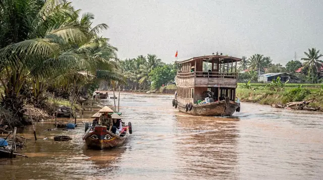
The Deep Mekong Delta Loop: Beyond Can Tho and My Tho
What is the deep Mekong Delta loop, and how is it different from a standard delta day trip?
It is a multi-day route that pushes past the near delta of My Tho, Ben Tre and Can Tho into farther provinces such as Chau Doc, Soc Trang and Ca Mau. Because those places sit much deeper into the delta, the loop needs several days rather than the single day that covers My Tho or Can Tho alone.
Why the delta needs more than one day
Most visitors to Ho Chi Minh City meet the Mekong Delta through a single day trip: a coach out to My Tho or Ben Tre, a short boat ride on the canals, lunch, and back to the city by evening. That trip is real, and it is a good introduction, but it only touches the edge of the delta closest to Saigon. The delta itself runs on for hundreds of kilometres beyond that first stop, through provinces that see far fewer day-trippers precisely because they are too far to visit and return from in a single day.
The deep Mekong Delta loop is the answer to that gap. Rather than treating the delta as a single afternoon detour, it treats it as a region worth several days, built around stops such as Can Tho, Chau Doc, Soc Trang and, at the far end, Ca Mau. Each of those places adds real distance and real character rather than repeating what came before.
This guide explains what the loop covers, how it differs from the standard delta circuit, and why the frequent habit of lumping Ca Mau and Chau Doc together with Can Tho or My Tho understates just how much farther into the delta those provinces sit.
The standard delta trip versus the deep loop
The confusion is understandable. On a map, My Tho, Ben Tre, Can Tho, Chau Doc and Ca Mau all sit inside the same broad region, the Mekong Delta, and travel blogs often mention them in the same breath. But treating them as interchangeable stops on the same day trip is a mistake that leads to badly planned itineraries.
My Tho and Ben Tre form the near delta: close enough to Ho Chi Minh City that a coach can reach them, spend a few hours on the canals and coconut groves, and return the same evening. Can Tho, the delta’s main city, sits a stage further out; it is still commonly done in a long single day from Saigon, though a two-day version that includes the dawn Cai Rang floating market is far more comfortable than rushing there and back.
Chau Doc, Soc Trang, Rach Gia and Ca Mau belong to a different category entirely. They sit deeper into the delta, closer to the Cambodian border or to the southern coastline, and reaching them, spending meaningful time on the ground, and returning to Ho Chi Minh City is not a same-day proposition. Treating a route that includes Ca Mau or Chau Doc as equivalent in scope to a My Tho day trip is the single most common planning error travellers make when they first look at a delta map.
What the deep loop actually covers
Can Tho and the floating market as a gateway
Most versions of the deep loop begin at Can Tho, the delta’s largest city, reached from Ho Chi Minh City on the expressway. An early start here matters, because the Cai Rang floating market trades at dawn and is at its best before the morning gets old. It is worth noting clearly that Cai Rang is at Can Tho, not at My Tho, a mix-up that appears often enough in casual trip notes to be worth correcting outright.
From Can Tho, the loop typically continues toward Sa Dec and its flower village, or heads directly toward the border provinces further west and south.
Chau Doc and the border country
Chau Doc sits near the Cambodian frontier and is one of the loop’s more distinctive stages. The town itself has a mixed Vietnamese, Khmer and Cham population, visible in its markets and places of worship. Nearby, Sam Mountain rewards a short climb or drive with wide views over the delta and the border plains, and the Tra Su cajuput forest offers quiet boat trips through flooded forest that feel markedly different from the open canals closer to Saigon. Chau Doc is also the usual jumping-off point for river routes continuing into Cambodia, which several multi-day itineraries build directly into the loop.
Soc Trang’s Khmer heritage
Soc Trang is best known for its Khmer pagodas, a reminder that the delta’s population has never been purely Vietnamese. The pagodas here, with their distinctive architecture and colour, are unlike anything seen in central Ho Chi Minh City and add a cultural layer that a short My Tho or Ben Tre trip simply does not reach.
Rach Gia and the road toward the coast
Rach Gia sits further west again, a working port town that many loops use as a staging point rather than a headline stop. Depending on the itinerary, it can also serve as a link toward the coast, though the emphasis in a deep delta loop stays inland rather than shifting to the sea.
Ca Mau, the far end of the country
Ca Mau marks the loop’s natural endpoint: it is the southernmost point of Vietnam, and reaching it carries a genuine sense of having gone as far as the map allows. The U Minh Ha forest nearby is the region’s other main draw, a wetland forest landscape that rewards travellers with an interest in the delta’s ecology rather than its markets and temples. Because of how far south Ca Mau sits, it is realistically only reachable as part of a multi-day route rather than tacked onto a trip built around Can Tho or My Tho.
A rough shape for the loop
There is no single fixed version of the deep Mekong Delta loop, and how it is built depends on how many of the far provinces a traveller wants to include. The table below sketches a common shape without assigning fixed day counts, since that depends on pace and how much time is spent at each stop.
| Stage | Focus | Notes |
|---|---|---|
| Can Tho | Cai Rang floating market, city and canals | Best done with an early start for the market |
| --- | --- | --- |
| Chau Doc | Sam Mountain, Tra Su forest, border town life | Common jumping-off point toward Cambodia |
| --- | --- | --- |
| Soc Trang | Khmer pagodas | Adds cultural depth rather than scenery |
| --- | --- | --- |
| Rach Gia | Staging point, working port | Often a transit stage rather than a headline stop |
| --- | --- | --- |
| Ca Mau | U Minh Ha forest, southernmost point | Furthest and least visited stage of the loop |
Many travellers choose a shorter version that covers only two or three of these stages rather than all five, and that is a reasonable way to scale the loop to the time available. What does not work well is trying to compress Chau Doc or Ca Mau into the same day trip pattern that suits My Tho — the distances involved make that approach impractical.
Getting into and around the deep delta
As with the rest of southern Vietnam, travel between these delta towns runs by road, in a coach, a private car or a “limousine” minibus, continuing onto boats once a route reaches the rivers and canals themselves. There is no meaningful rail option for these destinations, and the loop is not the kind of trip that lends itself to self-driving for most visitors, given the unfamiliar roads and the number of river crossings involved.
Within each town, boats take over for the parts that matter most: the floating market at Can Tho, the flooded forest at Tra Su near Chau Doc, and the canal networks that thread through the wetlands near Ca Mau. A Mekong Delta homestay is worth considering for at least one night on a longer loop, since it puts a traveller closer to the rhythm of the delta than a hotel in a provincial town does.
Booking the deep delta as tours
Because the deep loop covers so much ground, most travellers piece it together from a combination of guided day segments and boat excursions rather than a single continuous private itinerary. A two-day Can Tho tour built around the delta’s water lily season is a strong way to anchor the loop’s opening stage, giving proper time at the floating market rather than rushing through it.
For a more active middle stretch, a two-day cycling and cooking tour departing from Can Tho covers back roads and orchards that a coach window never reaches. Travellers extending the loop toward the border can look at a multi-day cruise that runs through Chau Doc toward Cambodia, which naturally covers the loop’s furthest inland stretch.
At the loop’s southern end, a canoe tour through the Ca Mau mangrove forest is the clearest way to experience the U Minh Ha area without arranging independent transport into terrain that is genuinely hard to navigate alone.
Planning around the loop’s demands
A few points are worth keeping in mind before committing to the deep loop rather than the standard delta day trip:
-
Distance compounds. Each stage of the loop — Can Tho, then Chau Doc or Soc Trang, then on to Ca Mau — adds real travel time on top of the last. A route that tries to do all of it in the time budgeted for a My Tho day trip will fail before it starts.
-
The far delta is quieter. Chau Doc, Soc Trang and Ca Mau see far fewer foreign visitors than Can Tho or My Tho, which means less English signage and fewer set tourist facilities, but also a more genuine sense of daily delta life.
- Weather follows the same two-season pattern as Saigon. The dry season, roughly December to April, is the easier window for a multi-day loop; the wet season’s short, heavy afternoon downpours are manageable but worth building slack around, especially for boat-heavy stages.
-
Tet disrupts everything. During the lunar new year, transport books out and many family-run boats and restaurants close for several days across the whole delta, not just in the cities. A loop planned around that period needs extra flexibility.
-
Pair it with the right starting point. Readers still deciding where to begin should compare My Tho against Can Tho as delta gateways before committing to the fuller loop described here.
Deep Mekong Delta loop: frequently asked questions
Is the deep Mekong Delta loop the same trip as a Can Tho or My Tho day trip?
No. A Can Tho or My Tho day trip stays in the near delta, close enough to Ho Chi Minh City to go and return the same day. The deep loop continues past Can Tho into Chau Doc, Soc Trang, Rach Gia or Ca Mau, which are markedly farther and cannot be folded into a single day alongside the near delta.
Why do people confuse Ca Mau and Chau Doc with Can Tho or My Tho?
All of these places sit within the Mekong Delta, so they get lumped together in casual trip talk. In practice Ca Mau and Chau Doc are considerably farther from Ho Chi Minh City than Can Tho or My Tho, and reaching them, spending real time there, and returning takes noticeably longer.
How many days does the deep delta loop typically take?
It is a multi-day undertaking rather than a single outing. Exactly how many days depends on how many of the far provinces are included and how much time is spent at each stop, but it is never a same-day trip once Chau Doc or Ca Mau is on the route.
What makes Chau Doc worth the extra distance?
Chau Doc sits near the Cambodian border and pairs river and canal scenery with Sam Mountain and the Tra Su cajuput forest, plus a strong Khmer and Cham presence that feels distinct from the delta closer to Saigon.
What is there to see around Soc Trang and Ca Mau?
Soc Trang is known for its Khmer pagodas, reflecting the delta’s mixed Vietnamese, Khmer and Chinese heritage. Ca Mau, at the southernmost point of the country, adds the U Minh Ha forest and a genuine sense of reaching the end of the map.
Can the deep loop be combined with Can Tho and the Cai Rang floating market?
Yes, and it usually is. Can Tho and the Cai Rang floating market, which trades at dawn, work well as an early stage of the loop before continuing on toward Chau Doc, Soc Trang or Ca Mau.
Is the deep delta loop suitable for a first visit to Vietnam?
It works best for travellers who already have some time in hand or who are specifically drawn to the delta rather than trying to cover it in passing. First-time visitors on a short schedule are usually better served by a shorter, closer itinerary.
Mekong Delta Cruises and Floating Markets
Verified deep-linked GetYourGuide tours. Book through these links and we earn a small commission at no cost to you.
GetYourGuide does not provide a product photo for this activity — the image shows the meeting point, photographed by us.